Wednesday, September 19, 2012

Randy Pierce first blind person to climb NH's 48 summits


A local man is not letting his disability keep him from reaching new heights. He's one of about 50 people who have hiked all of New Hampshire's toughest mountains during winter.

But he's a real trail blazer; Randy Pierce is the first blind person to climb New Hampshire’s 48 summits in the White Mountains. What’s more, he did it in one winter, and all he needed was a little help from his guide dog and best friend, Quinn.


Read more

Hiker safe after dramatic rescue in NH mountains

September 19, 2012

FRANCONIA, N.H. (AP) -- New Hampshire Fish and Game officials say rescue crews who endured high winds and torrential rain to rescue an injured hiker in the White Mountains likely saved his life.

Fifty-nine-year-old Edward Bacon of Northville, Mich., was on the third day of a five-day solo hike around Franconia Notch when he fell Tuesday afternoon and seriously injured his hip. Authorities say Bacon crawled to an area where he was able to get brief cell phone reception and called for help.


A team sent by the Appalachian Mountain Club reached Bacon around 6:20 p.m., followed soon after by New Hampshire Fish and Game officers and volunteers. Facing wind gusts of 80 mph and swollen rivers and streams, rescuers carrying the injured man didn't reach the trailhead until after 3 a.m. Wednesday.

Best Loop Hikes New Hampshire's White Mountains to the Maine Coast (Best Hikes)Best Loop Hikes New Hampshire's White Mountains to the Maine Coast (Best Hikes) by Jeffrey Romano
Buy new: $11.53 / Used from: $6.18
Usually ships in 24 hours
Franconia Notch and the Women Who Saved It (Revisiting New England)Franconia Notch and the Women Who Saved It (Revisiting New England) by Kimberly Jarvis
Buy new: $25.95 / Used from: $4.88
Usually ships in 24 hours
Franconia Notch/North Conway Trails Illustrated Map # 740Franconia Notch/North Conway Trails Illustrated Map # 740 byNational Geographic Maps
Buy new: $10.16 / Used from: $9.14
Usually ships in 24 hours
Guide Book to the Franconia Notch and the Pemigewasset ValleyGuide Book to the Franconia Notch and the Pemigewasset Valley byFrank Oliver Carpenter
Buy new: $16.97 / Used from: $15.15
Usually ships in 24 hours

Monday, September 17, 2012

{Photo's} Rattlesnake Mountain, Rumney NH


Summary
Rattlesnake Mountain, located on the south end of the Carr Mountain ridge, features views in nearly all directions from its ledgy summit. A fire burned a significant portion of the mountain in the summer of 2008.

This trail climbs moderately to a loop over the ledges of Rattlesnake Mtn., providing excellent views over the Baker River Valley for a modest effort.

Summit Elevation
1,594 feet

Trail time
1.3 miles, 1000 ft., 1 hr. 10 min.
2.5 miles (Complete loop), 1050 ft, 1 hr. 45 min.


Feature Name:Rattlesnake Mountain
County:Grafton County
Latitude:43.8072929
Longitude:-71.8403594


Credits:
White Mountain Guide, 29th: AMC's Comprehensive Guide to Hiking Trails in the White Mountain National Forest (Appalachian Mountain Club White Mountain Guide)

White Mountain Guide, 29th: AMC's Comprehensive Guide to Hiking Trails in the White Mountain National Forest (Appalachian Mountain Club White Mountain Guide)
By Steven D. Smith, Mike Dickerman

List Price:$24.95
Price:$16.47 & eligible for FREE Super Saver Shipping on orders over $25.Details

Availability: Usually ships in 24 hours
Ships from and sold by Amazon.com

Sculptured Rocks Geologic Site, Groton NH


If you are passing through the area, this is a nice sight to stop and see. The well-carved gorge is quite impressive. This geological wonder is another New Hampshire attraction that is believed to have been formed by a retreated glacier from the great Ice Age, about 10,000 years ago. Swimming is a locally popular activity at this spot in the summer, but it is only safe in low-water conditions. You might spot people jumping off the gorge walls for a bit of adventure. Others may be enjoying some of the water-filled potholes alongside the river. Swimming can be dangerous here; if the water level looks too high, avoid the temptation, especially within the gorge.


Sculptured Rocks Natural Area, which spans 272 acres, is a unique example of nature's powerful yet delicate artistry. The Cockermouth River carved a narrow canyon in bedrock on its way to Newfound Lake, beginning as the last ice age drew to a close. Nature used grains of sand suspended in the current to carve the walls of the canyon into curious shapes and create potholes in the bedrock.


Pets are permitted in the park. See the NH State Parks Pets Policy for more information.


View Larger Map


National Geographic Guide to State Parks of the United States, 4th Edition (National Geographic's Guide to the State Parks of the United States)National Geographic Guide to State Parks of the United States, 4th Edition (National Geographic's Guide to the State Parks of the United States) by National Geographic
Buy new: $16.50 / Used from: $12.51
Usually ships in 24 hours
National Geographic Guide to National Parks of the United States, 7th Edition (National Geographic Guide to the National Parks of the United States)National Geographic Guide to National Parks of the United States, 7th Edition (National Geographic Guide to the National Parks of the United States) by National Geographic
Buy new: $15.87 / Used from: $10.47
Usually ships in 24 hours
RV Camping in State ParksRV Camping in State Parks by D.J. Davin
Buy new: $15.95 / Used from: $21.53
Usually ships in 24 hours
National Geographic Guide to the National Parks of the United States, 6th Edition (National Geographic Guide to National Parks of the United States)National Geographic Guide to the National Parks of the United States, 6th Edition (National Geographic Guide to National Parks of the United States) by National Geographic
Buy new: $15.94 / Used from: $3.37
Usually ships in 24 hours
National Geographic Guide to the State Parks of the United States, 3rd Edition (National Geographic Guide to the State Parks of the U.S.)National Geographic Guide to the State Parks of the United States, 3rd Edition (National Geographic Guide to the State Parks of the U.S.) byNational Geographic Society
Buy new: $25.00 / Used from: $1.09
Usually ships in 24 hours
Off the Beaten Path: A Travel Guide to More Than 1000 Scenic and Interesting Places Still Uncrowded and InvitingOff the Beaten Path: A Travel Guide to More Than 1000 Scenic and Interesting Places Still Uncrowded and Inviting
Buy new: $19.80 / Used from: $12.99
Usually ships in 24 hours


Saturday, September 15, 2012

{PHOTO's} Deer at Mine Falls Park, Nashua NH

3 Deer @ Mine Falls Park, Nashua NH
©Dave Peatfield 2012
#923458


Format


Mother and Daughter Deer Portrait
Mine Falls Park, Nashua NH
©Dave Peatfield 2012
#303954


Format


View Larger Map

Mine Falls Park
Park hours are 6 AM to 10 PM.

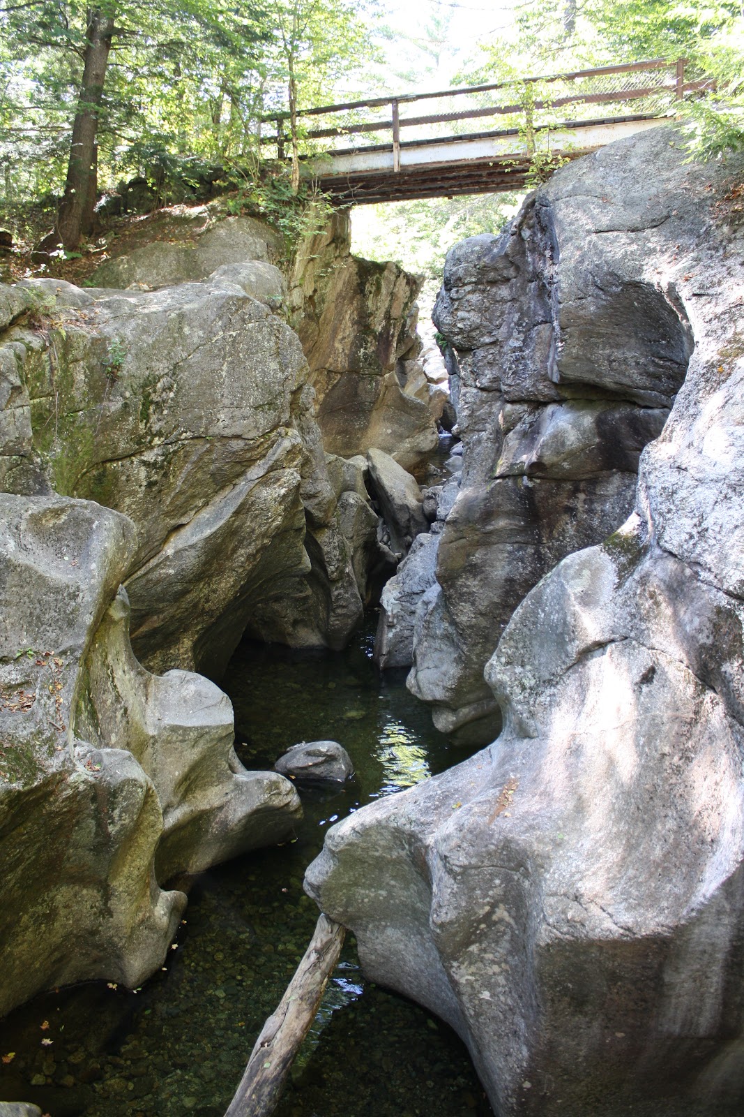
Mine Falls Park is one of the most instantly recognizable and vital parts of the city of Nashua. The park is located in the heart of the city and was purchased in 1969 with city and federal Land and Water Conservation Fund (LWCF) monies. The 325-acre park includes forest, wetlands, and open fields; it is bordered on the north by the Nashua River and on the south by the Millpond and canal system.

Visitors enjoy numerous passive recreation opportunities such as walking, boating, fishing, cross-country skiing, and biking. The park also includes several fields for organized sports.

The name "Mine Falls" derives from the 1700s, when low quality lead was supposedly mined from the island below the falls. In the early 1800s the potential of the Nashua River to drive the wheels of industry was recognized. Workers used shovels and mules to dig the three-mile long canal, which provides a vertical drop of 36 feet at the mills.

The Gatehouse near the falls was built in 1886—with the first gates being built in 1826—and it still brings the river to the Millpond. Currently, the gatehouse is the focus of a middle school student lead restoration project. The hydroelectric plant near the falls was built in 1984.

In 1987 the Nashua River Canal and the Nashua Manufacturing Company Historic District (the Millyard) were placed on the National Register of Historic Places. In 1992 the park trails were designated part of the New Hampshire Heritage Trail system, which extends 130 miles along the Merrimack River from Massachusetts to Canada.

Mine Falls Park Rules
*These rules are legally enforcable by City Ordinance Article II, Section 15-16 Parks & Playgrounds

Do:

Carry out all trash
Keep pets on leash
Pick up pet waste
Stay on established trails
Get a permit from the Nashua Park & Rec. Dept.* for Group Events

No:

Motorized vehicles
Alcohol
Fires
Discharge of Firearms
Camping

Don't:

Harm or deface trees, plants, wildlife, or rocks
Damage or deface signs or structures, such as bridges, rocks, etc.
Create or modify trails without City approval
Remove Park signs
Cut trees
Start fires

Park abuse should be reported to the police: (603) 594-3500