Tuesday, November 17, 2015

Grand Canyon West UPDATED #Photo #DavePeatfield

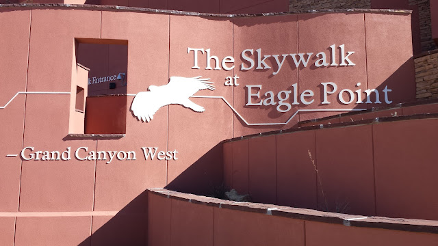
Home of Eagle Point and the Skywalk.


Eagle Point

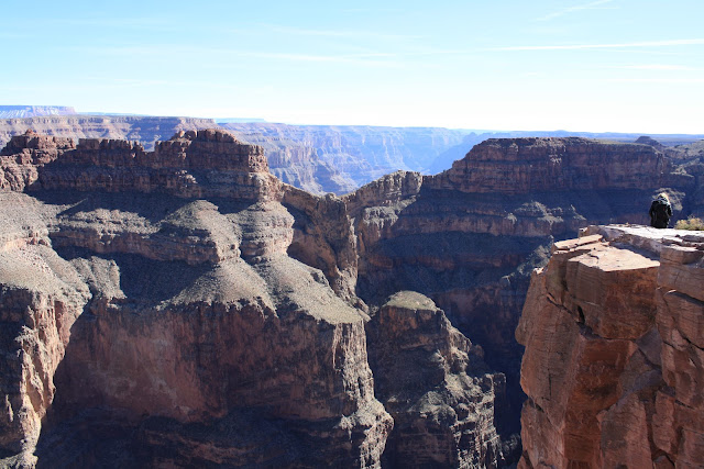
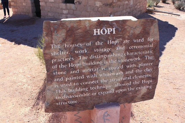
Eagle Point, a popular stop in Grand Canyon West, is the site of the famous Grand Canyon Skywalk and a collection of traditional Native American dwellings, including Hualapai Ranch, a western-themed town that evokes the spirit of the old west through gun fights, cattle drives, cowboy games, and horseback rides.

One of the highlights of Eagle Point is the Skywalk, which provides some of the most astounding, unobstructed views of the Grand Canyon possible. The horseshoe-shaped glass-bottomed Skywalk juts over a side of the Grand Canyon, suspended 70 feet/21 meters beyond the west rim and 4,000 feet/1,200 meters above the Colorado River. From Eagle Point you can take the 8-mile/12-kilometer trek to the Supai Village. A trail from Hualapai Hilltop drops steeply through a starkly beautiful landscape. Once you reach the village, you’ll find a café, general store, and a post office.

Be aware this is not part of the Grand Canyon National Park.  It is soley owned and operated by the Hualapai Indian Reservation.  It is not a self guided tour of the Grand Canyon as you will be bused from access point to access point.  Tickets must be purchased at the reception area just beyond the main entrance to the canyon access gate.  You will be asked if you are carrying any weapons at the gate.  If you do not wish to be donating your weapon to the tribe, leave it home, as they are illegal on the reservation!

Stop one is western themed prop town where there is a created town of how the west once was.  There are some activities for the kids and some food is available at this stop for purchase.  This is not a working town but a recreated stage of days past "touristy".

Stop two is at the Skywalk where you have access to the skywalk and some access to the perimeter of the canyon at Eagle Point.  In order to walk the Skywalk you must locker any cameras, phones, handbags, etc.  There are photographers available at 3 points on the skywalk to take pictures of you and they will be available to purchase on your way out to the gift shop. There is a food truck on sight at this stop, but was not open on the day of our visit.

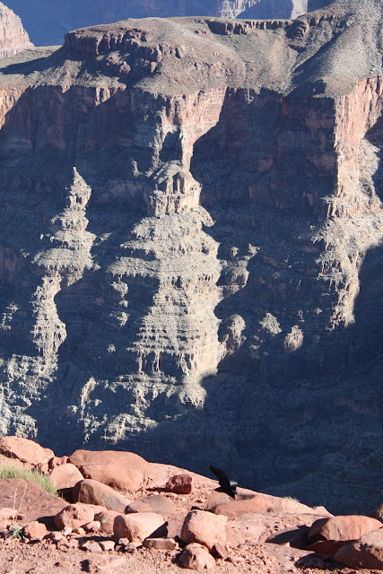
Stop three and for me the most enjoyable and awe inspiring.  Although very crowded with various tour bus groups it was the most impressive visually.  There is a very nice walkway of ledge approximately 1000 yards in length that is open on both sides into the Canyon.  It has a small summit out at its tip that allows you a 360 degree view of the elbow in the Colorado River called Guano Point. Food is only available at this location if you purchased the meal package at the reception gate before getting on the buses.  You will be abruptly turned away if you have no ticket.  Be prepared for these points and you will very much enjoy this tourist attraction.

This location is much more of a commercial tour then a casually paced self-guided tour that you can do at your own pace on the South-Rim of the Grand Canyon National Park.


Joshua Tree Forest

Joshua Tree Forest


The Skywalk on the left


Guano Point

Guano Point


Monday, November 16, 2015

Good morning Arizona!

Nice panoramic view of our morning view for the week!


As sunlight shines on the West #Photo

The sun is beginning to reveal what the evening left us as a gift.

Morning View, Verde Santa Fe AZ #Photo

Although cloudy and quite brisk this morning (currently 34) the view is quite enjoyable. The elevations just above us got a nice fresh coating of snow last night while we got a pounding rain. The weather is very changeable out hear, similar to back home in New England. Our wandering today will take us to Jerome and it's ghost town.

Saturday, November 7, 2015

Farm Tour New Hampshire Style #Photo


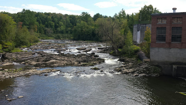
Over the rocks - Waterbury VT #Photo

Working Water Powered Power Plant in the woods of Waterbury VT
Dave Peatfield


Covered Bridge - Johnson VT #Photo

Power House Covered Bridge - Johnson VT

The Power House Covered Bridge, also known as the School Street Covered Bridge, is a covered bridge from 1872 that crosses the Gihon River off State Route 100C in Johnson, Vermont, USA. It was listed on the National Register of Historic Places in 1974. The bridge's name is from a now obsolete hydroelectric generating station just upstream from it.  

The bridge is of Queen post truss design by an unknown builder.


White Mountain's Beauty #Photo

This is a sunset photo taken in Lincoln NH Last November.  It was a frosty late day photo and the atmospheric conditions were very colorful.  This photo is unaltered and was quite a beautiful sight.  There was just enough haze in the atmosphere to remove the glare of the sun.


Thursday, November 5, 2015

New England Fall #Photo


Photo taken on a farm in New Hampshire while Apple Picking.

Sun Setting in Belfast Maine #Photo

Ending of another Day - Belfast ME


Old Mill of days past and Covered Bridge - Johnson VT #Photo


Old Abandoned water power plant and a currently active covered bridge in Johnson VT


Friday, September 4, 2015

Canyon wall rock threatening to crash into base of Arizona dam (Rock is 50 feet high, 30 feet wide)

**
FLAGSTAFF, Ariz. —A massive piece of rock is at risk of crashing down from a canyon wall to the base of an Arizona dam, prompting the government to send in a crew of rappelers to keep the slab in place.

The 500,000-pound slab -- weighing more than many jumbo jets -- cracked and began to break away from the canyon wall last week because of what the U.S. Bureau of Reclamation says is erosion that is typical for that type of rock. The area below the slab includes a passageway to a boat ramp, a machine shop and water and power facilities for the Glen Canyon Dam, located in Page near the Arizona-Utah border.

The Bureau of Reclamation has cut off access to the boat ramp, putting some rafting trips on hold until the rock can be secured.

A three-person crew has been scaling the towering walls to drill bolts that range from 6 feet to 8 feet long into the sandstone. Six bolts were placed in the canyon wall a week ago before a small chunk broke loose and crashed down, hitting a building and leaving a pile of rubble, Bureau of Reclamation spokesman Chris Watt said.

"It's just plain luck that it didn't cause more damage because we don't know how big of chunks are going to fall," he said. "If more of it falls, that's a real concern."

The slab measures 30 feet at its widest point and is 50 feet tall. Its thickness ranges from 6 inches to 4 feet, he said.

The plan is to attach bolts in the area above the crack to make sure it's safe enough for crews to then work on the part of the slab that is in jeopardy of falling. Temperatures can top 110 degrees on the face of the wall, limiting the hours the crew can work, Watt said. The work isn't expected to be complete until the first week of October.

The slab is about 150 feet away from the edge of the dam, which is not in danger of being hit by the rock. Watt also said the location is at constant risk of falling rock, and engineers have constructed protections at the site such as stronger buildings and an area designed to catch falling rock.

For now, a rafting company that takes tourists from the base of the dam down the Colorado River to Lees Ferry has cut down on the number of daily trips. Colorado River Discovery General Manager Korey Seyler said the company is now launching at Lees Ferry, about 15 miles downstream, and traveling up the river until it gets the OK to resume normal operations.

"It certainly has had a major impact on us, as all of our trips depart from the base of the dam," he said. "We've ceased having the ability to access the area."

Rockfalls aren't uncommon at Glen Canyon. The layer of rock known as Navajo sandstone is common in the Southwest, particularly in Utah, and is prone to cracks due to erosion.

This crack is the largest one in years, and workers at the dam have been watching it closely, Watt said.

Frank Talbott, a former river guide who lives just outside Page, said rocks have fallen into the river and taken out part of a catwalk that goes to the lower part of the dam.

"They just happen, and it doesn't hurt anything, unless it's right at a special place at the dam," he said.

**This photo taken Wednesday, Sept. 2, 2015, and provided by Frank Talbott shows workers stabilizing a sandstone wall along the Glen Canyon dam near Page, Ariz. The massive slab of rock is threatening to come crashing down at the base of the Arizona dam. The three-person crew has been working to stabilize the sandstone that forms the walls surrounding the Glen Canyon dam near the Arizona-Utah border. The slab weighs 500,000 pounds and recently began to crack due to erosion. The area below the slab includes a boat ramp, and water and power facilities for the dam. (Frank Talbott via AP)Associated Press