25 Tuzigoot Rd, Clarkdale, AZ 86324
Ancient hilltop pueblo with a nearby visitor center featuring artifacts of the Sinaguan Indians.
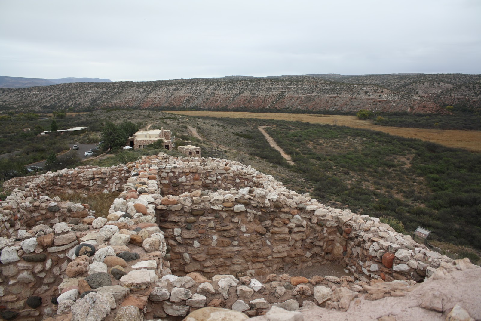
Tuzigoot National Monument preserves a 2- to 3-story pueblo ruin on the summit of a limestone and sandstone ridge just east of Clarkdale, Arizona, 120 feet above the Verde River floodplain.
Tuzigoot National Monument Map:
http://ow.ly/UVzuu
Tuzigoot National Monument (Yavapai: ʼHaktlakva, Western Apache: Tú Digiz) preserves a 2- to 3-story pueblo ruin on the summit of a limestone and sandstone ridge just east of Clarkdale, Arizona, 120 feet above the Verde River floodplain. The Tuzigoot Site is an elongated complex of stone masonry rooms that were built along the spine of a natural outcrop in the Verde Valley. The central rooms stand higher than the others and they appear to have served public functions. The pueblo has 110 rooms. The National Park Service currently administers 58 acres, within an authorized boundary of 834 acres.
Tuzigoot is Apache for "crooked water", from nearby Pecks Lake, a cutoff meander of the Verde River. Historically, the pueblo was built by the Sinagua people between 1125 and 1400 CE. Tuzigoot is the largest and best-preserved of the many Sinagua pueblo ruins in the Verde Valley. The ruins at Tuzigoot incorporate very few doors. Instead they use trapdoor type openings in the roofs, and use ladders to enter each room.
At this site, remains of pithouses can be seen as well as petroglyphs, although the petroglyphs can only be viewed on certain days of the week.
The monument is on land once owned by United Verde/Phelps Dodge. The corporation sold the site to Yavapai County for $1, so that the excavation could be completed under the auspices of federal relief projects. The county in turn transferred the land to the federal government.
Tuzigoot was excavated from 1933 to 1935 by Louis Caywood and Edward Spicer of the University of Arizona, with funding from the federal Civil Works Administration and Works Project Administration. In 1935–1936, with additional federal funding, the ruins were prepared for public display, and a Pueblo Revival-style museum and visitor center was constructed.
Franklin D. Roosevelt designated Tuzigoot Ruins as a U.S. National Monument on July 25, 1939. The Tuzigoot National Monument Archeological District was listed on the National Register of Historic Places on October 15, 1966.
The ruins are surrounded by the tailings pond of the former United Verde copper mine at Jerome. The tailings have recently been stabilized and revegetated. (Source:
http://ow.ly/UVAL0)