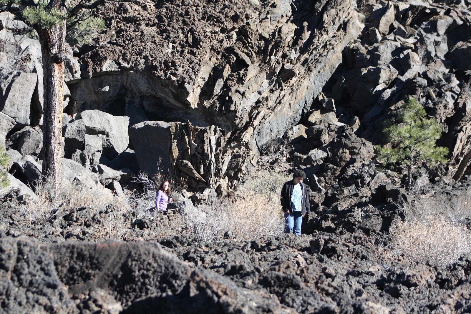
Sunset Crater Volcano! Roughly 930 years ago, the eruption of this volcano reshaped the surrounding landscape, forever changing the lives of people, plants and animals. Hike the trail through the lava flow and cinders and you’ll likely discover colorful, ruggedly dramatic geological features coexisting with twisted Ponderosa Pines and an amazing array of wildlife.
Most visitors drive through the 34 mile scenic loop that winds from Highway 89 through Sunset Crater Volcano and Wupatki National Monuments. The scenic loop leads you from the high Ponderosa Pine forests of Sunset Crater, down nearly 2,000 feet in elevation to the red rocks and painted desert vistas of Wupatki.
What happens when the earth cracks open beneath you, spewing hot cinders and poisonous gases high into the air? Just 1,000 years ago, that happened at Sunset Crater Volcano. At first, it must have been terrifying. Plants burned, and people and wildlife fled. But as ten centuries have passed, life has slowly returned, beautiful and strong.
Here you can learn what rangers, scientists, and visitors like you have discovered through the preservation of Sunset Crater Volcano.
The Bonito Lava Flow is one of several flows that streamed out from the base of Sunset Crater Volcano about 930 years ago. The 1200° C (2200° Fahrenheit) liquid formed a river of black lava that inundated over four and a half square kilometers (almost two square miles) of the landscape before it cooled and solidified.
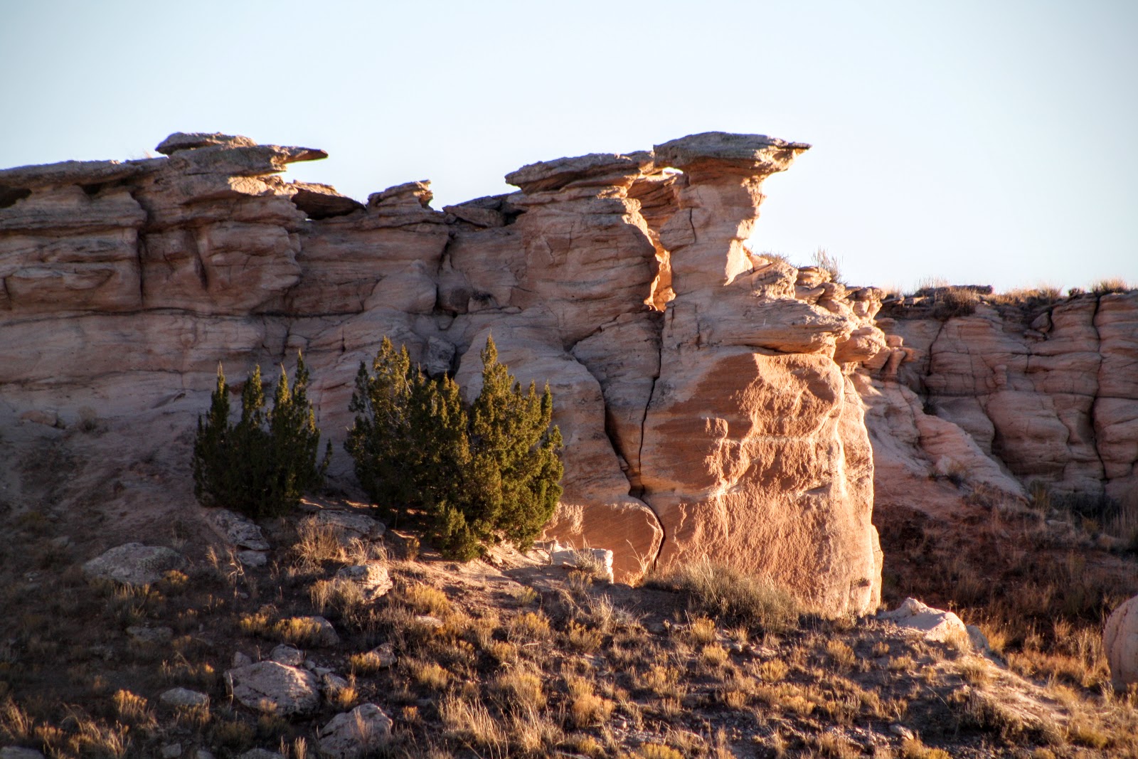
Petrified Forest National Park is a United States national park in Navajo and Apache counties in northeastern Arizona. Named for its large deposits of petrified wood, the fee area of the park covers about 170 square miles (440 square kilometers), encompassing semi-desert shrub steppe as well as highly eroded and colorful badlands. The park's headquarters is about 26 miles (42 km) east of Holbrook along Interstate 40 (I-40), which parallels the BNSF Railway's Southern Transcon, the Puerco River, and historic U.S. Route 66, all crossing the park roughly east–west. The site, the northern part of which extends into the Painted Desert, was declared a national monument in 1906 and a national park in 1962. About 800,000 people visit the park each year and take part in activities including sightseeing, photography, hiking, and backpacking.
Averaging about 5,400 feet (1,600 m) in elevation, the park has a dry windy climate with temperatures that vary from summer highs of about 100 °F (38 °C) to winter lows well below freezing. More than 400 species of plants, dominated by grasses such as bunchgrass, blue grama, and sacaton, are found in the park. Fauna include larger animals such as pronghorns, coyotes, and bobcats; many smaller animals, such as deer mice; snakes; lizards; seven kinds of amphibians, and more than 200 species of birds, some of which are permanent residents and many of which are migratory. About half of the park is designated wilderness.
The Petrified Forest is known for its fossils, especially fallen trees that lived in the Late Triassic, about 225 million years ago. The sediments containing the fossil logs are part of the widespread and colorful Chinle Formation, from which the Painted Desert gets its name. Beginning about 60 million years ago, the Colorado Plateau, of which the park is part, was pushed upward by tectonic forces and exposed to increased erosion. All of the park's rock layers above the Chinle, except geologically recent ones found in parts of the park, have been removed by wind and water. In addition to petrified logs, fossils found in the park have included Late Triassic ferns, cycads, ginkgoes, and many other plants as well as fauna including giant reptiles called phytosaurs, large amphibians, and early dinosaurs. Paleontologists have been unearthing and studying the park's fossils since the early 20th century.
The park's earliest human inhabitants arrived at least 8,000 years ago. By about 2,000 years ago, they were growing corn in the area and shortly thereafter building pit houses in what would become the park. Later inhabitants built above-ground dwellings called pueblos. Although a changing climate caused the last of the park's pueblos to be abandoned by about 1400 CE, more than 600 archeological sites, including petroglyphs, have been discovered in the park. In the 16th century, Spanish explorers visited the area, and by the mid-19th century a U.S. team had surveyed an east–west route through the area where the park is now located and noted the petrified wood. Later, roads and a railway followed similar routes and gave rise to tourism and, before the park was protected, to large-scale removal of fossils. Theft of petrified wood remains a problem in the 21st century. (Soruce: Wikipedia, the free encyclopedia http://ow.ly/VIAkl)