Tuesday, November 17, 2015

Grand Canyon West UPDATED #Photo #DavePeatfield

Home of Eagle Point and the Skywalk.


Eagle Point

Eagle Point, a popular stop in Grand Canyon West, is the site of the famous Grand Canyon Skywalk and a collection of traditional Native American dwellings, including Hualapai Ranch, a western-themed town that evokes the spirit of the old west through gun fights, cattle drives, cowboy games, and horseback rides.

One of the highlights of Eagle Point is the Skywalk, which provides some of the most astounding, unobstructed views of the Grand Canyon possible. The horseshoe-shaped glass-bottomed Skywalk juts over a side of the Grand Canyon, suspended 70 feet/21 meters beyond the west rim and 4,000 feet/1,200 meters above the Colorado River. From Eagle Point you can take the 8-mile/12-kilometer trek to the Supai Village. A trail from Hualapai Hilltop drops steeply through a starkly beautiful landscape. Once you reach the village, you’ll find a café, general store, and a post office.

Be aware this is not part of the Grand Canyon National Park.  It is soley owned and operated by the Hualapai Indian Reservation.  It is not a self guided tour of the Grand Canyon as you will be bused from access point to access point.  Tickets must be purchased at the reception area just beyond the main entrance to the canyon access gate.  You will be asked if you are carrying any weapons at the gate.  If you do not wish to be donating your weapon to the tribe, leave it home, as they are illegal on the reservation!

Stop one is western themed prop town where there is a created town of how the west once was.  There are some activities for the kids and some food is available at this stop for purchase.  This is not a working town but a recreated stage of days past "touristy".

Stop two is at the Skywalk where you have access to the skywalk and some access to the perimeter of the canyon at Eagle Point.  In order to walk the Skywalk you must locker any cameras, phones, handbags, etc.  There are photographers available at 3 points on the skywalk to take pictures of you and they will be available to purchase on your way out to the gift shop. There is a food truck on sight at this stop, but was not open on the day of our visit.

Stop three and for me the most enjoyable and awe inspiring.  Although very crowded with various tour bus groups it was the most impressive visually.  There is a very nice walkway of ledge approximately 1000 yards in length that is open on both sides into the Canyon.  It has a small summit out at its tip that allows you a 360 degree view of the elbow in the Colorado River called Guano Point. Food is only available at this location if you purchased the meal package at the reception gate before getting on the buses.  You will be abruptly turned away if you have no ticket.  Be prepared for these points and you will very much enjoy this tourist attraction.

This location is much more of a commercial tour then a casually paced self-guided tour that you can do at your own pace on the South-Rim of the Grand Canyon National Park.
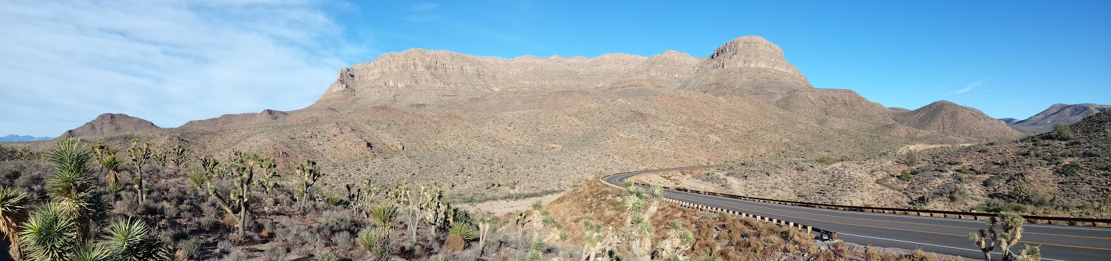


Joshua Tree Forest

Joshua Tree Forest


The Skywalk on the left


Guano Point

Guano Point


Monday, November 16, 2015

Good morning Arizona!

Nice panoramic view of our morning view for the week!


As sunlight shines on the West #Photo

The sun is beginning to reveal what the evening left us as a gift.

Morning View, Verde Santa Fe AZ #Photo

Although cloudy and quite brisk this morning (currently 34) the view is quite enjoyable. The elevations just above us got a nice fresh coating of snow last night while we got a pounding rain. The weather is very changeable out hear, similar to back home in New England. Our wandering today will take us to Jerome and it's ghost town.

Saturday, November 7, 2015

Farm Tour New Hampshire Style #Photo


Over the rocks - Waterbury VT #Photo

Working Water Powered Power Plant in the woods of Waterbury VT
Dave Peatfield


Covered Bridge - Johnson VT #Photo

Power House Covered Bridge - Johnson VT

The Power House Covered Bridge, also known as the School Street Covered Bridge, is a covered bridge from 1872 that crosses the Gihon River off State Route 100C in Johnson, Vermont, USA. It was listed on the National Register of Historic Places in 1974. The bridge's name is from a now obsolete hydroelectric generating station just upstream from it.  

The bridge is of Queen post truss design by an unknown builder.


White Mountain's Beauty #Photo

This is a sunset photo taken in Lincoln NH Last November.  It was a frosty late day photo and the atmospheric conditions were very colorful.  This photo is unaltered and was quite a beautiful sight.  There was just enough haze in the atmosphere to remove the glare of the sun.


Thursday, November 5, 2015

New England Fall #Photo


Photo taken on a farm in New Hampshire while Apple Picking.

Sun Setting in Belfast Maine #Photo

Ending of another Day - Belfast ME


Old Mill of days past and Covered Bridge - Johnson VT #Photo


Old Abandoned water power plant and a currently active covered bridge in Johnson VT


Friday, September 4, 2015

Canyon wall rock threatening to crash into base of Arizona dam (Rock is 50 feet high, 30 feet wide)

**
FLAGSTAFF, Ariz. —A massive piece of rock is at risk of crashing down from a canyon wall to the base of an Arizona dam, prompting the government to send in a crew of rappelers to keep the slab in place.

The 500,000-pound slab -- weighing more than many jumbo jets -- cracked and began to break away from the canyon wall last week because of what the U.S. Bureau of Reclamation says is erosion that is typical for that type of rock. The area below the slab includes a passageway to a boat ramp, a machine shop and water and power facilities for the Glen Canyon Dam, located in Page near the Arizona-Utah border.

The Bureau of Reclamation has cut off access to the boat ramp, putting some rafting trips on hold until the rock can be secured.

A three-person crew has been scaling the towering walls to drill bolts that range from 6 feet to 8 feet long into the sandstone. Six bolts were placed in the canyon wall a week ago before a small chunk broke loose and crashed down, hitting a building and leaving a pile of rubble, Bureau of Reclamation spokesman Chris Watt said.

"It's just plain luck that it didn't cause more damage because we don't know how big of chunks are going to fall," he said. "If more of it falls, that's a real concern."

The slab measures 30 feet at its widest point and is 50 feet tall. Its thickness ranges from 6 inches to 4 feet, he said.

The plan is to attach bolts in the area above the crack to make sure it's safe enough for crews to then work on the part of the slab that is in jeopardy of falling. Temperatures can top 110 degrees on the face of the wall, limiting the hours the crew can work, Watt said. The work isn't expected to be complete until the first week of October.

The slab is about 150 feet away from the edge of the dam, which is not in danger of being hit by the rock. Watt also said the location is at constant risk of falling rock, and engineers have constructed protections at the site such as stronger buildings and an area designed to catch falling rock.

For now, a rafting company that takes tourists from the base of the dam down the Colorado River to Lees Ferry has cut down on the number of daily trips. Colorado River Discovery General Manager Korey Seyler said the company is now launching at Lees Ferry, about 15 miles downstream, and traveling up the river until it gets the OK to resume normal operations.

"It certainly has had a major impact on us, as all of our trips depart from the base of the dam," he said. "We've ceased having the ability to access the area."

Rockfalls aren't uncommon at Glen Canyon. The layer of rock known as Navajo sandstone is common in the Southwest, particularly in Utah, and is prone to cracks due to erosion.

This crack is the largest one in years, and workers at the dam have been watching it closely, Watt said.

Frank Talbott, a former river guide who lives just outside Page, said rocks have fallen into the river and taken out part of a catwalk that goes to the lower part of the dam.

"They just happen, and it doesn't hurt anything, unless it's right at a special place at the dam," he said.

**This photo taken Wednesday, Sept. 2, 2015, and provided by Frank Talbott shows workers stabilizing a sandstone wall along the Glen Canyon dam near Page, Ariz. The massive slab of rock is threatening to come crashing down at the base of the Arizona dam. The three-person crew has been working to stabilize the sandstone that forms the walls surrounding the Glen Canyon dam near the Arizona-Utah border. The slab weighs 500,000 pounds and recently began to crack due to erosion. The area below the slab includes a boat ramp, and water and power facilities for the dam. (Frank Talbott via AP)Associated Press

Friday, June 12, 2015

Anker Compact Car Jump Starter and Portable Charger Power Bank

Amazon.com: Anker Compact Car Jump Starter and Portable Charger Power Bank with 400A Peak Current, Advanced Safety Protection and Built-In LED Flashlight:  http://ow.ly/NZQA8


Wednesday, June 3, 2015

What's a Ghost Moose? How Ticks Are Killing an Iconic Animal

By Christine Dell'Amore, National Geographic
PUBLISHED JUNE 01, 2015

EAST MOXIE TOWNSHIP, Maine—Lee Kantar crouches over a dead moose calf and pulls a clump of hair from its straggly shoulder.


A few days earlier, the sickly ten-month-old animal had waded through deep snow to this sun-dappled stand of spruce trees in western Maine, laid down, and died.

"See how white those hairs are?" says Kantar, a moose biologist for the state.

It's a telltale sign that the calf was becoming a "ghost moose"—an animal so irritated by ticks that it rubs off most of its dark brown hair, exposing its pale undercoat and bare skin.

With their skinny necks, emaciated bodies, and big, hairless splotches, these moose look like the walking dead as they stumble through the forest.

And in recent years in New England, ghost moose sightings have become increasingly familiar.

The reason is likely climate change, biologists say, which is ushering in shorter, warmer winters that are boosting the fortunes of winter ticks. The tiny creatures latch on to moose here in staggering numbers: One moose can house 75,000 ticks, which are helping to drive a troubling rise in moose deaths, especially among calves. (See "New Climate Change Report Warns of Dire Consequences.")

Mostly wiped out in New England by hunting in the 1800s, moose populations had begun rebounding in the late 1970s, thanks to a suddenly abundant food source—new spruce-fir forests that took root following a pest outbreak that wiped out much of the former forest.

By the late 1990s, about 7,500 moose were living in New Hampshire. But in 2013, the population there had dropped to 4,500. In vastly bigger Maine, which has about 60,000 moose—the densest population in the lower 48 states—there's a suspected decline, but there's less data.

It's unlikely that these leggy deer will disappear entirely from New England, but the surge in moose deaths has made investigating the causes a top priority for the region's scientists.

Though winter tick is the main culprit, scientists are trying to unravel the bigger mystery of what else is contributing to the deaths. Moose are highly susceptible to several kinds of parasites, and it's likely that many factors are at play.

What's a Ghost Moose? How Ticks Are Killing an Iconic Animal See Full Story Here


Friday, May 29, 2015

A Walk In the Woods - Redford and Nolte

I am looking forward to seeing this in the fall.

I placed hiking the Appalachian Trail on my bucket list, and has been firmly planted there for the past few years.  It will probably have to happen after I retire or win the lottery, but I will not stray from this adventure at some point down the road.

Redford and Nolte Take 'A Walk In the Woods'

The adaptation of Bill Bryson's AT memoir gets its first trailer. Robert Redford and Nick Nolte are set to hit the Appalachian Trail later this year in the long-awaited adaptation of Bill Bryson’s classic memoir A Walk in the Woods. Redford’s earnestness and Nolte’s barely comprehensible speech patterns look to provide plenty of laughs while Nick Offerman pops in as a sardonic REI employee.

The film is scheduled to hit theaters September 2nd.

Check out the first full trailer below:

Saturday, May 23, 2015

The Most Terrifying Mountain Bike Ride Ever

The Most Terrifying Mountain Bike Ride Ever
by Outside Television 4:47 mins


Via Ferrata is a short film about the first descent of a fixed-rope climbing-route on a mountain bike. "Honestly don't want to do this ride again. It's stupidly dangerous." FIlmed in the amazing Brenta Dolomites with a drone.


Saturday, May 9, 2015

As baby turtles emerge, some tips to keep them safe


YORK, Maine — As the nighttime temperatures warm up, and ponds and other water bodies stabilize at 40-50 degree temps, our ancient reptilian friends are emerging from hibernation and on the move.

Watch for snapping turtles, spotted turtles, and other species crossing roads from hibernation spots to their late spring/early summer habitats, a press release from the Center for Wildlife urges.

“We received three calls just today about people finding turtles crossing roads, wanting to know what to do. After they emerge from hibernation, female turtles go from their water source to a sandy upland habitat to lay their eggs; following the tracks of their mothers, grandmothers, and many other ancestors before them. We are moved by how closely connected our community is to these ancient creatures. If you find a turtle in the road this year and it is safe to do so, simply move the turtle to the side of the road in the direction they were facing. If you put them back in the water and they haven’t laid their eggs yet, they have to come all the way out and cross that road again” shares Center for Wildlife’s Executive Director Kristen Lamb.

Also, each year around Mother's Day in our region, turtle hatchlings the size of nickels and quarters will be emerging from their nests to make their first trek to water bodies. Although tiny, they are completely on their own from the moment their mother lays their eggs and covers them expertly in the nest. Incredibly, baby painted and other turtles in our climate hatch from their eggs in September/October, and spend all winter hibernating beneath the ground. When they emerge in the spring, they instinctually move toward the body of water their mothers came from.

What are some things you can do to help turtles this season? Follow these 10 tips to make a difference for a species that is facing rapid decline due to habitat destruction and the illegal pet trade: ...cont.... As baby turtles emerge, some tips to keep them safe - News - fosters.com - Dover, NH

Monday, April 6, 2015

Grit and wonder: 2015’s thru-hikers reflect on trail hardships and thrills

The stack of boxes piling up on the counter of the outfitter store at Nantahala Outdoor Center is any indication, thru-hiker season is coming fast. The parcels of food, reminders of home and creature comforts are welcome diversions from the travel-light lifestyle on the Appalachian Trail, where miles are many and luxuries are few.

“A lot of people ask about what you’re thinking about [on the trail],” said Youngblood, an 18-year-old hiker whose off-trail name is P.J. Coleman, as he sorted through his just-opened box of mail drop goodies. “Ninety-nine percent of the time, you’re thinking about food.”

His buddy Gadget, 20, who’s also known as Robert Smith, holds up a hard-candy caramel in shiny gold wrapping. Those individually wrapped sugar rushes are the key to making it up the hard hills, he says. For his part, Youngblood has a stash of Now-and-Laters and Sour Punch Straws.

Don’t forget the coffee, peanut butter and trail mix, chimed in Jessica “Lemon” Romain, who was taking a zero day to recover from a rolled ankle. And also, those reminders of home. Mom’s cookies, a handwritten note, anything with a personal touch.

“A mail drop just reminds me I have people at home who support me,” said Youngblood, who chose to do the trail rather than going straight to college. “That’s what keeps me going.”

Shane Shelley, who works at the outfitter shop, has seen that sentiment play out again and again. He recently handed a package to a girl who opened it to find, in addition to the food she herself had packed, some postcards from her mom. The find made her teary.

“Something to get in their stomach but also to get in their heart,” Shelley said of the boxes. That day alone, they’d gotten 14 boxes delivered and will probably work up to 40 by the time thru-hiker season peaks.


Full Story....

Hiking safety tips as the season is upon us

Don't hike alone. You are safest with a group; neither a single partner nor a dog is a guarantee of safety. Be creative. If in doubt, move on. Always trust your instincts about other people.

Leave your hiking plans with someone at home and check in frequently. Establish a time you will check in upon completion of your trip, as well as a procedure to follow if you fail to check in. On longer hikes or thru-hikes, provide ATC's number, 304-535-6331.

Be wary of strangers. Be friendly, but cautious. Don't tell strangers your plans. Avoid people who act suspiciously, seem hostile, or are intoxicated.

Don't camp near roads. Be aware that anywhere people congregate — including shelters and designated campsites — may have greater risk. When tenting, find a location not easily seen from the trail.

The Appalachian Trail Conservancy discourages the carrying of firearms.

Eliminate opportunities for theft. Don't bring jewelry. Hide your money. If you must leave your pack, hide it, or leave it with someone trustworthy.

Use the Trail registers (the notebooks stored at most shelters). If someone needs to locate you, or if a serious crime has been committed along the trail, the first place authorities will look is in the registers.

In an emergency, note where you are and call 911. Report emergencies or incidents to ATC at incident@appalachiantrail.org or by calling 304-535-6331. Suspicious or illegal behavior should be reported to the local rangers or local law enforcement (911 usually works, but other phone numbers are on official AT maps) as well as ATC.

Be mentally prepared for the risks you may encounter. If you encounter trouble, chances are a law-enforcement officer or ranger will not be nearby and a cellphone may not work.

Always carry current trail maps and know how to use them.

Stay alert. Pay attention to details of your surroundings and people you encounter, and look for anything that does not fit or sends a red flag. It is easier to avoid getting into a dangerous situation than to get out of one. Trust your instincts about strangers.

Avoid hitchhiking or accepting rides: Hikers needing to get into town should make arrangements beforehand and budget for shuttles or a taxi.

Weather-related hiking safety tips:

Pay attention to the changing skies. Sudden spells of "off-season" cold weather, hail, and even snow are common along many parts of the Appalachian Trail. Winter-like weather often occurs in late spring or early fall in the Southern Appalachians, Vermont, New Hampshire and Maine.

Hypothermia: A cold rain can be the most dangerous weather for hikers, because it can cause hypothermia, a dangerous lowering of the body's core temperature due to exposure to cold, wind and rain chill. Dress in layers of synthetic clothing, eat well, stay hydrated, and know when to take refuge in a warm sleeping bag and tent or shelter.

Lightning: The odds of being struck by lightning are low, but if a thunderstorm is coming, immediately leave exposed areas. Boulders, rocky overhangs, and shallow caves offer no protection from lightning. Sheltering in hard-roofed automobiles or large buildings is best. Avoid tall structures, such as ski lifts, flagpoles, power line towers, and the tallest trees, solitary rocks, or open hilltops and clearings. If caught in the open, crouch down on a pad, or roll into a ball.

Heat: Dry hot summers are surprisingly common along the trail. Water may be scarce on humid days, sweat does not evaporate well, and many hikers face the danger of heat stroke and heat exhaustion if they haven't taken proper precautions. Wear a hat and sunscreen and stay well hydrated.

Source: Appalachian Trail Conservancy www.appalachiantrail.org.

Appalachian Trail Fest

The Appalachian TrailFest is April 17-19 in Hot Springs to celebrate the arrival of Appalachian Trail thru-hikers with bike riding, river rafting, music, outdoor crafts, hiking and more. For more information, call 828-622-9575 or email hstrailfestA@gmail.com.

Sunday, April 5, 2015

In wake of death, Appalachian Trail experts highlight need for safety

ASHEVILLE, NC – Considering the enormity of the 2,189-mile long Appalachian Trail, which sweeps across 14 states and through some of the most remote and rugged country in the Eastern United States, hiker deaths, such as the recent one in Maryland, are surprisingly rare.

So say veteran Appalachian Trail hikers and officials with the Appalachian Trail Conservancy, the nonprofit that oversees maintenance and management of the trail.

Jason Parish, 36, of Philadelphia, died March 15 when a tree felled by strong winds crashed on top of him near the Ed Garvey Shelter near the southern end of the Maryland trail section. A hiking companion, Michael Sparks, said the tree was dead and had been marked with a pink ribbon, apparently meant to identify it for cutting.

Full Story: Citizen-Times....

Saturday, April 4, 2015

Top 5 Waterfall Hikes | Finger Lakes Trail NY


The Finger Lakes region of New York State is known for its array of stunning, cascading waterfalls – some even call it a ‘waterfall mecca.’ Whether you’re thru-hiking the trail and want a place to pause for some meditation and reflection on how far you’ve come on your long-distance hiking journey, or you just want to cool off in a natural-fed swimming pool at the base of one of the area’s many falls, these are the top five waterfalls to visit along the Finger Lakes Trail:
  • Upper, Middle + Lower Falls in Letchworth State Park
  • Watkins Glen Waterfalls via Stone Stairs
  • Shequaga/Montour Falls South of Watkins Glen
  • Lucifer Falls + Lower Falls in Robert H. Treman State Park
  • Buttermilk Falls in Buttermilk Falls State Park
more info.....
Top 5 Waterfall Hikes | Finger Lakes Trail


Great New England Swimming Holes

If you do choose to visit any of these places, please Leave No Trace!  Not only do you need to make sure to remove all your own trash, but we ask that you try to pick up any trash left by others. There have been dozens of swimming holes closed off to the general public over the last 20 years due to disrespectful visitors. These swimming holes are some of the most wonderful places in all of New England.


Saturday, March 28, 2015